Campus Map
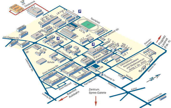
The red route resembles the route to the Panta Rhei Building (follow the signs on the Campus).
North:
- Flugplatz = airfield
- Lazarett = former military area (now: offices of Faculty 4)
South:
- Bahnhof = train station
South East:
- Zentrum = downtown (city)
- AT: Studio for Architecture students (Atelier)
- Audi: Auditorium Maximum
- Bibl.: Library
- BL: Laboratory for building material
- FMPA: Institute for material research and testing (Forschungs- und Materialprüfanstalt)
- G 1: Language center
- G 2: Faculty 3 building
- GH: Big lecture hall (Großer Hörsaal)
- HG: Main Building (Hauptgebäude)
- HS: Lecture hall
- IBZ: International meeting center
- LB: Laboratory building
- LG: Seminar building
- LH: Laboratory hall
- MZG: Multipurpose building
- SH: Swimming pool
- SW: Studentenwerk (student office, responsible for organisation of hostels, canteen etc.)
- TH: Gymnasium
- WH: Students hostel
- ZeVe: Administration building (Zentralverwaltung)
- Mensa: Canteen
- Sportplatz: Sports ground