Planning Studies
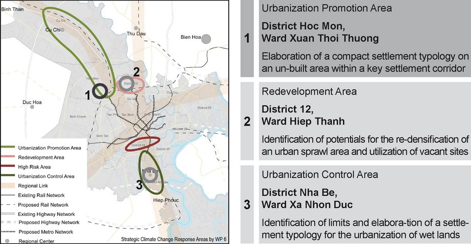
As “Application” component, the design of exemplary planning studies for climate change adapted and energy efficient neighbourhoods serves as a showcase to evaluate and demonstrate the potentials and limits of new settlements under the utilization of the presented urban design principles. Furthermore, the studies play a crucial role in demonstrating, simulating and testing the effective application of adaptation and mitigation strategies. Three study sites were identified according to WP 6’s “Strategic Climate Change Response Areas”. These sites represent different sets of challenges, which will become major fields of action for future urban planning in HCMC due to climate change.
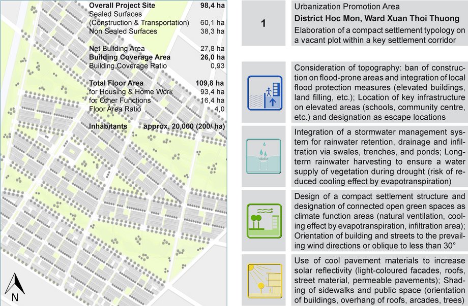
The planning study of District Nha Be shows that a further urbanization of HCMC’s wetlands – if not completely avoidable – has to be concentrated on existing elevated land or already raised transportation corridors to prevent a further excessive land claiming and large-scale land filling. Therefore, the proportion of feasible construction land is very low. In opposite to current development plans for these areas (e.g. HCMC’s planned Harbour City) the average population density has to be limited to approximately 30-35 inhabitants/ ha. This calls for a significant higher utilization of elevated areas in the north of HCMC. However, the planning study of District Hoc Mon evidences that the average population density can be increased only marginally (200-220 inhabitants/ ha) compared to current housing developments. Indeed, the elaborated settlement typologies allows for a higher utilization of built-up surfaces, but at the same time the proportion of unsealed open spaces as climate function areas is much higher. For urban sprawl areas like District 12, the planning study shows, that the protection of strategic open spaces is of top priority and the utilization of vacant sites for further construction is lower-ranked.


