Monitoring program
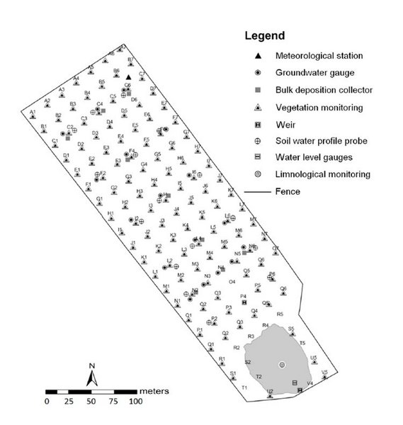
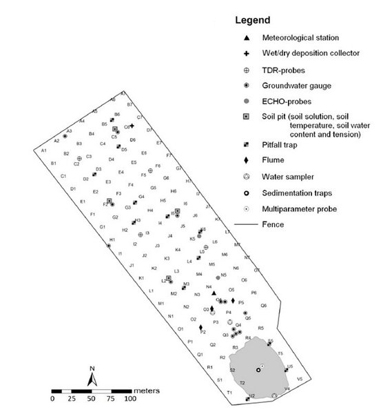
Within the catchment monitoring of environmental parameters is carried out to measure meteorological, hydrologic and soil conditions as well as deposition inputs. The permanent monitoring installations are oriented along a regular grid of 20 x 20 m with marked grid points. Rows in NE-SW direction are numbered from 1 to 7 and rows in NW-SE direction are labeled with A to V. In a first step soil samples have been taken in autumn 2005 at each grid point which proved the Quaternary substrate to be relatively homogenous both spatially and with depth. In addition to these permanent installations other measurements, records and samplings are carried out with respect to vegetation, soil fauna and limnology. Aerial photographs are taken regularly in spring, summer and autumn using a microdrone.
Results of the monitoring program are published in Ecosystem Development, an open access series edited by the Chicken Creek Project. A detailed description of monitoring methods can be found in vol. 2 of this series.
The monitoring project at the Chicken Creek Catchment is supported by BTU Cottbus-Senftenberg and the Ministry of Science, Research and Culture (MWFK) of the State of Brandenburg.