Research Project RoMo
The RoMo (Raw Materials Mongolia) project intended to explore how the recently developed multi-sensor ultra-light airborne investigation system of the chair can be used for mineral resource exploration in Mongolia. The work focused on the practical use of high-resolution magnetic and radiometric data acquired with an ultralight aircraft, taking into account the specific geological setting, large distances, and often difficult climatic conditions of the country.
The project started within the framework of the German–Mongolian Raw Materials Partnership signed in 2011. One of the main challenges in Mongolia is the sheer size of the territory and the limited accessibility of many regions, which makes detailed ground-based surveys difficult to carry out on a regional scale. In this context, airborne methods offer a way to obtain continuous subsurface information over large areas. RoMo was therefore designed not only as a research project, but also as a long-term test of an airborne measurement concept developed at BTU Cottbus–Senftenberg, based on an ultralight aircraft and a modular sensor setup.
After the first project phase (RoMo I, 2018–2019), which focused on system testing and initial survey areas, the work was continued as RoMo II between 2020 and 2023 under the program Deutsch-Mongolische Hochschule Phase III. During this second phase, the emphasis shifted more strongly towards capacity building and academic cooperation, while at the same time extending the airborne investigations to additional regions. An important objective was to strengthen the role of the German-Mongolian Institute for Resources and Technology (GMIT) as a central institution for applied resource exploration in Mongolia.
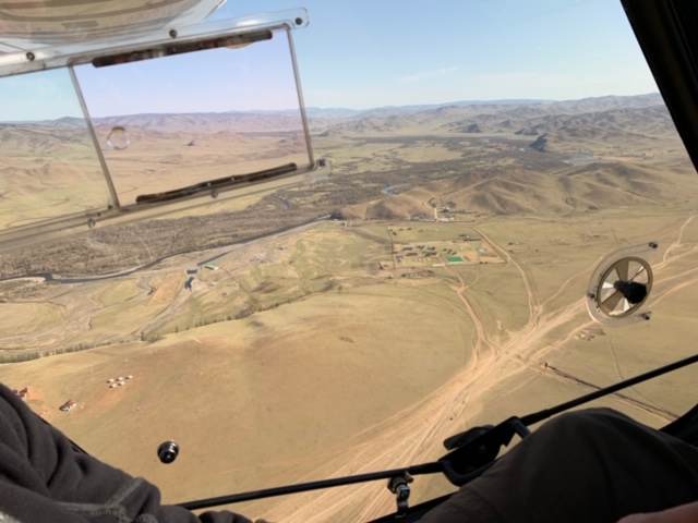
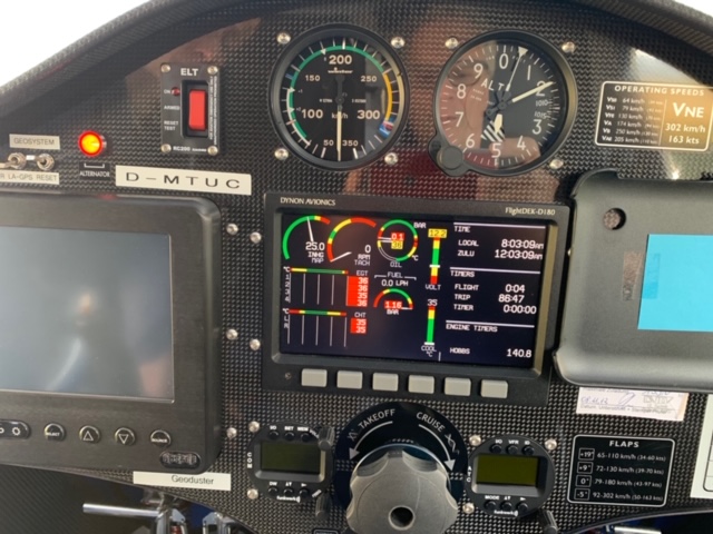
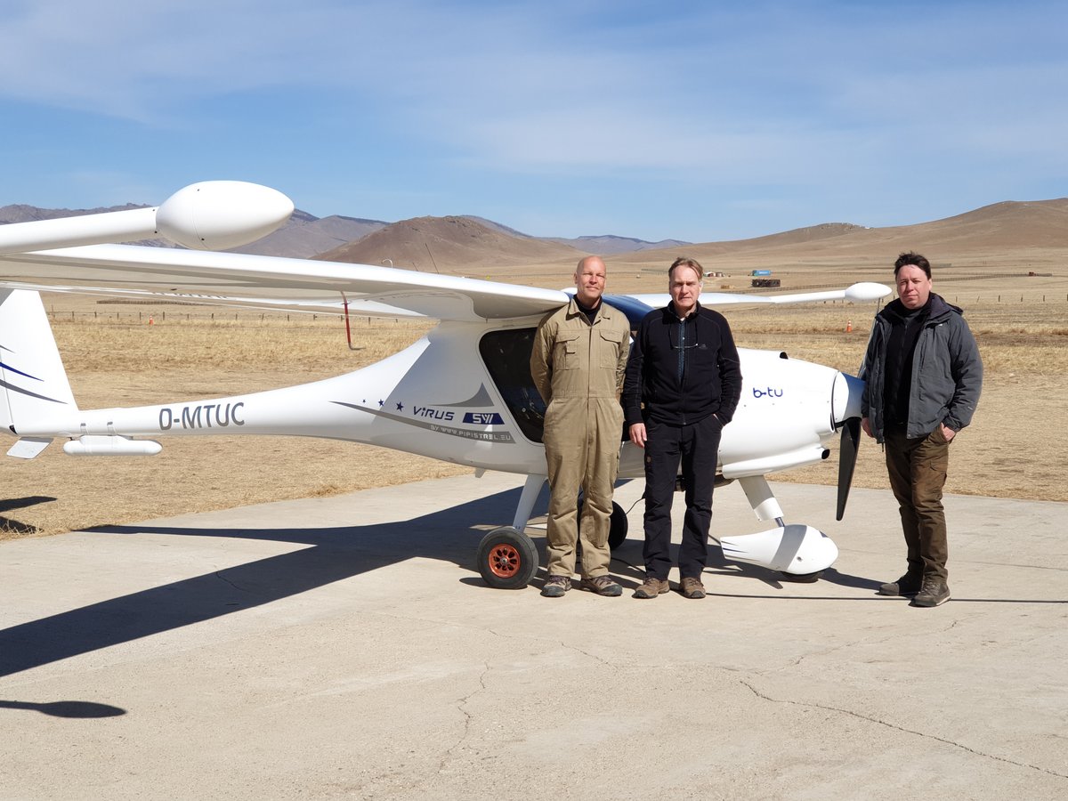
The airborne surveys were carried out with the multi-sensor airborne investigation system of the chair (details see at chapter ‘Development of a multi-sensor airborne investigation system’) a modified Pipistrel Virus SW ultralight aircraft, built entirely from carbon-fiber composites in order to keep magnetic interference as low as possible. The platform was equipped with two GEM K-GSMP-35 magnetometers, a Medusa 4-litre CsI gamma-ray spectrometer, and a VLF-EM receiver. Navigation and altitude control were supported by GPS as well as radar and laser altimeters. Due to the low stall speed of the aircraft, it was possible to fly slowly and follow the terrain at a nearly constant ground clearance of about 100 m, which proved important for achieving consistent data quality.
During RoMo I and II, airborne surveys were conducted in the Mandalgobi, Bayanhongor and Janchivlan areas of Central Mongolia, comprising a total of approximately 1,856 line-kilometres in RoMo I and 2,263 line-kilometres in RoMo II, resulting in more than 4,100 line-kilometres overall. The magnetic data revealed structures that were not evident in existing geological maps, while the radiometric results helped to better constrain lithological variations.
In the second phase, RoMo II, the surveys were extended to additional parts of Central Mongolia, including areas of the Gobi region, the Hangai Mountains, and especially the greater Ulaanbaatar region. In total, more than 2,200 additional line-kilometres were flown. For each area, several potential-field maps were generated and discussed with Mongolian authorities and academic partners.
A significant part of the later project phase was dedicated to the safe return of the D-MTUC system from Mongolia to Germany in 2023. Owing to the geopolitical situation and the war in Ukraine, the transport required an alternative route via China and involved a combination of rail, sea, and road transport. After its return to the home base in Welzow, the system was inspected, repaired where necessary, and partially recalibrated. At the same time, the academic collaboration continued through staff exchanges, training activities at BTU, the organization of DAAD Summer Schools, and the supervision of students work based on anomalies identified during the airborne surveys.
RoMo was carried out jointly by BTU Cottbus–Senftenberg, the German-Mongolian Institute for Resources and Technology (GMIT), and the Mineral Resources and Petroleum Authority of Mongolia (MRPAM), with funding provided by the German Federal Ministry for Economic Cooperation and Development (BMZ) through GIZ and DAAD. Technical support was provided by GeoDuster and GeoIntrepid. The experience gained during both project phases forms the basis for further development of the airborne system and for future applications in mineral exploration as well as environmental and groundwater-related studies.