UPWARDS
UAV Platooning for the efficient monitoring and processing of large areas and the coordination of complex subtasks - UPWARDS

In the UPWARDS work package, we are mainly looking at agricultural applications for the early detection and control of diseases, fungal and insect infestations or the monitoring of biodiversity. In Brandenburg, 40-50% of agricultural land is used for cereal and maize cultivation and another 28% for field forage such as green maize and field grass. In addition, the average farm area is very large at 238 hectares. This results in a particular need for monitoring solutions for large areas.
With the so-called Precision Farming principle, only those plants and soil areas are treated with appropriate measures (including pesticides, herbicides, fungicides, fertilizers) that actually need it. This reduces the amount of chemicals applied to achieve a reduction in costs for the farmers and healthier food.
In order to detect nutrient deficiencies and diseases such as fungal infestation, the individual plants must be recorded with a maximum image resolution of 1cm² per pixel. For example, some of these disorders lead to specific punctual colour changes on the leaves. Other plant diseases can be detected with NDVI cameras (Normalized Difference Vegation Index) in the red to infrared spectrum, which allow the amount of chlorophyll in the plants to be estimated. Obviously this leads to a very high effort if the whole field is to be checked by many farm workers. Also the analysis of satellite photos does not provide enough details and cannot be used for this purpose due to the high error rate.
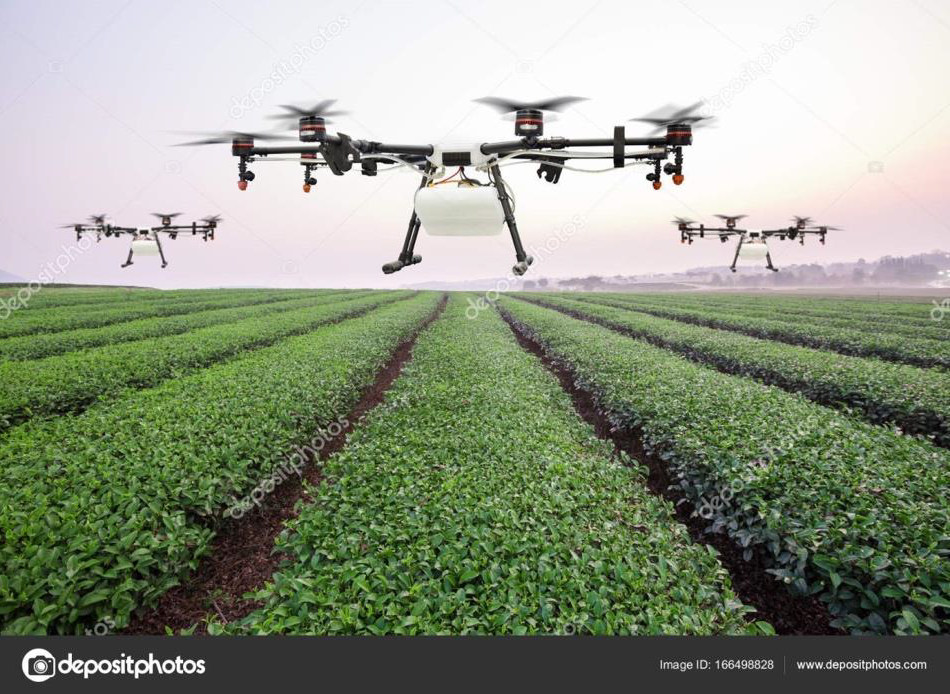
The use of drones in agriculture allows the precise and timely detection and mapping of different plant problems by flying over the entire field equipped with cameras. Among others, photo cameras with a very high resolution and multispectral or NDVI cameras can be used. The captured images are transferred to a high-performance computer for evaluation, for example in a cloud application using artificial intelligence algorithms. The mapping provides usable information directly on the field, which agents are to be applied, in which quantity and on which plants.
Although drones can take pictures of large fields, the effort involved is still immense. Each drone must be manually controlled by a pilot. In addition, the flight time is limited to about 30 minutes and the pilot must always ensure that the drone is returned to the landing site in time to charge or replace the batteries. When using several drones in parallel, the pilots must coordinate their actions well, e.g. to avoid collisions, especially near the landing site.
Within the UPWARDS work package we investigate the autonomous flight of several drones within a defined task. In the agricultural scenario, up to 5 drones are to fly over a defined field area of approx. 1000m * 1000m and record images over the entire area. Further drones are to apply suitable pesticides and nutrients based on these images.
The swarm flight, similar to a swarm of bees, accelerates the completion of the mission because many drones share the task. This speeds up, for example, the mapping of the field, so that plant protection measures can be carried out earlier and the fields can be checked more frequently. Thanks to autonomous flight, a single pilot can command several drones and only needs to intervene manually in the control of individual drones in the event of a malfunction.
Unfortunately, swarming flight makes autonomous operation of the drones very difficult: The drones must maintain minimum distances from each other to avoid collisions. They also need mechanisms for bypassing and possibly detecting obstacles (eg trees, power lines, buildings) and for wind-dependent adjustment of flight parameters, while they are not allowed to leave the predefined boundaries of the field. Especially wind-dependent effects lead to an energy consumption that is difficult to predict. If the charge level falls below a limit, the respective drone flies back to the loading platform and later continues a potentially different part of the mission. Therefore the drones cannot have a fixed global plan of when which drone flies where.
It is therefore necessary for the drones to continuously exchange their flight path parameters with each other in order to detect potential collisions at an early stage and react accordingly. This requires a very precise localization of the drones and reliable real-time communication with low latency. Existing approaches use centralized control through communication with the ground station. However, the communication latency caused by this limits the maximum allowed speed of the drones and increases the safety distances.
Instead, UPWARDS is based on the use of radar systems and DGPS, as well as direct communication between the drones via a new generation of UWB radio modules. These modules enable precise two-way ranging and data exchange between the drones at a very high sampling rate of several thousand measurements per second compared to the state of the art.
However, the range of these UWB radio modules is much smaller than the areas to be covered. Therefore, unlike in formation flight, it cannot be assumed that continuous radio connections exist. A middleware is necessary to abstract the dynamic radio neighborhood suitable for the mission planning software on the drone. In addition, all UWB modules within radio range share the time slots for pairwise data exchange. Therefore, as the number of drones increases, it may become necessary to additionally integrate passive procedures such as One Way Ranging and Broadcasts.
